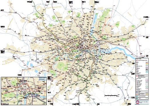
A new geographical map of London’s railways has been released by TfL in response to a freedom of information request. The request strangely appears to be from last September, hence the map is a little out of date in terms of who runs what. It does include future plans, some of which are yet to materialise, so it’s still useful. The map is a large PDF file which can be viewed by clicking the image below.
4 thoughts on “Geographical Rail Map”
Comments are closed.

Interesting in that it shows the Liverpool St./Moorgate and Farringdon/Barbican Crossrail station complexes.
It also shows the Connaught Tunnel taking a novel route under the Royal Docks. So not that geographically accurate !!!
Hi Mike,
Given that it was produced a year ago and is only showing the Crossrail route as an approximation, I’m not sure I’d be too worried.
I have two bugbears about geographical maps, and this map fails on both counts, though it is otherwise a good effort.
1. Just east of South Kensington on the Piccadilly line there are 4 sharp bends.
2. At Baker St, the Jubilee line runs parallel to the Bakerloo line, north of it. Travelling eastbound, the Jubilee actually veers further north before a >90° curve towards Bond Street.
Hi John,
You are of course right, but I’m not sure that it really matters. The main thing the map is trying to show is the relationship between the stations and their surroundings.